Overview
In this case study we will explain why Calibrated Reflectance Panels (CRPs) are an absolute necessity for the proper processing of multispectral (MS) images. We will explain what they are, how they work and why, without using them, you are showing the weather and not crop health.
We will conclude with a real example using a multispectral mission of a Southern Ontario corn farm.
What is a CRP?
A CRP is a physical target that has precise reflectance values across multiple wavelengths. It provides an absolute baseline for your multispectral sensor.
How does This Work?
You take an image of the CRP (with your MS drone) before and after your flight. When you process your images, you combine your CRP panel photos ALONG WITH your aerial flight images into your processing platform (I use PIX4D Fields) and run the process.
What Does This Do?
The images of the CRP “tell” the software to adjust the images to the baseline of the card. So, if your images are brighter than the baseline it tells the software to reduce the brightness. If it is less bright than the baseline, it tells the software to increase the brightness.
Why Does This Matter?
Remember, a MS sensor reads the reflection of the vegetation being imaged. So, if it is sunny, overcast or the sun is at a different angle the vegetation will reflect differently. It will be the same leaf with the same health characteristics. But, since the reflection is different, it will give a different MS reading. And that is where the CRP comes in. By telling the software to adjust the image to the baseline, it is now making an “apples-to-apples” comparison. The index reading will be adjusted to the same baseline whether it is 10am, 2pm, summer or fall. One limit worth knowing: the panel sets the baseline for the light at the time of the flight. If conditions change partway through, such as a passing cloud, the drone’s built-in sunlight sensor compensates, but not perfectly. That’s why I fly in steady light whenever possible. Using a CRP is the only way to ensure you have a proper comparison of the health of your vegetation throughout the year. An index reading of 0.45 in July reflects a comparable vegetation condition to 0.45 in September.
Otherwise, all your MS sensor is doing is telling you what the weather was that day.
A Real Example
Now, let’s illustrate this with a real example of an imaging of our corn farm.
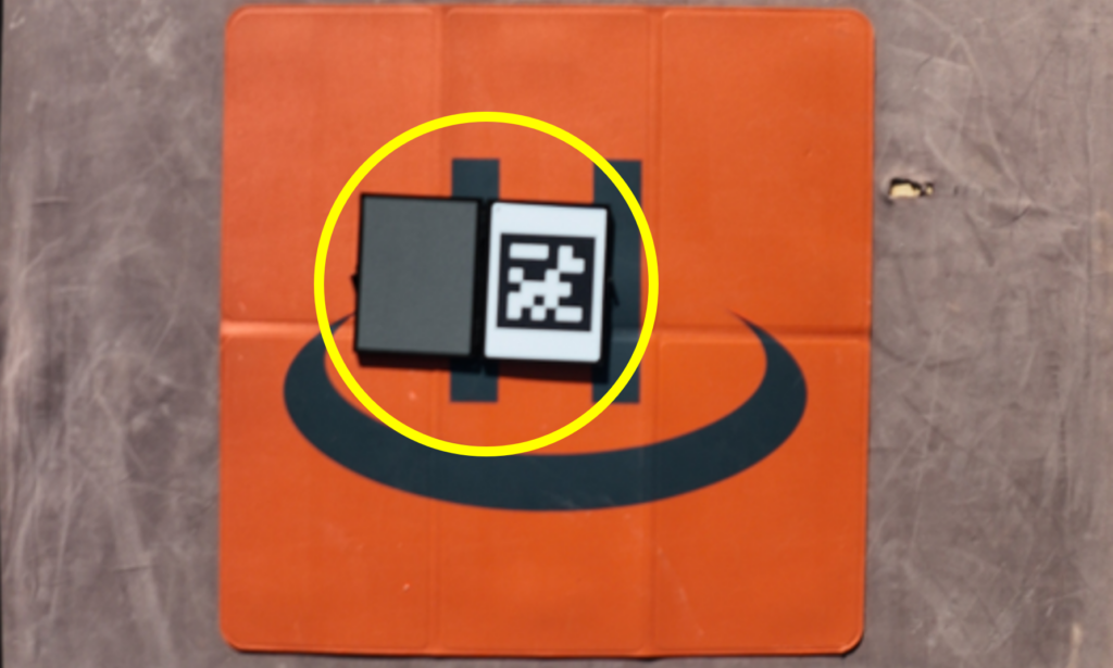
First, we take an image of the CRP (inside the circle) with our Multispectral drone. We also take one after the flight.
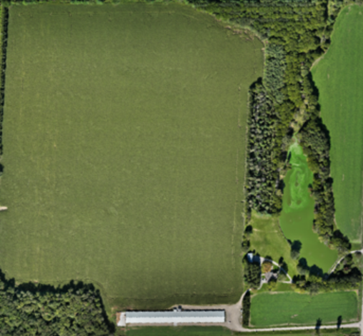
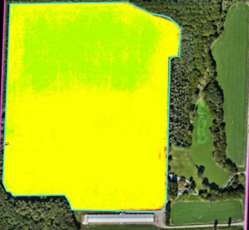
We then fly the mission of the entire property. But, during processing, we crop the image to isolate just the active growing areas. This ensures our data purely reflects the target vegetation. This prevents surrounding non-crop features like forests, roads and structures from skewing the index data.
Full Property
Crop Only carve-out
Results
We examined NDRE data collected in early July.
There is a modest differential between data collected with and without a CRP. Differentials in mid-summer are generally smaller due to direct sun angles, relatively stable weather and high canopy cover. In our example, the results were similar: the field’s average NDRE was 0.483 without a CRP and 0.486 with one, a difference of under 1%.
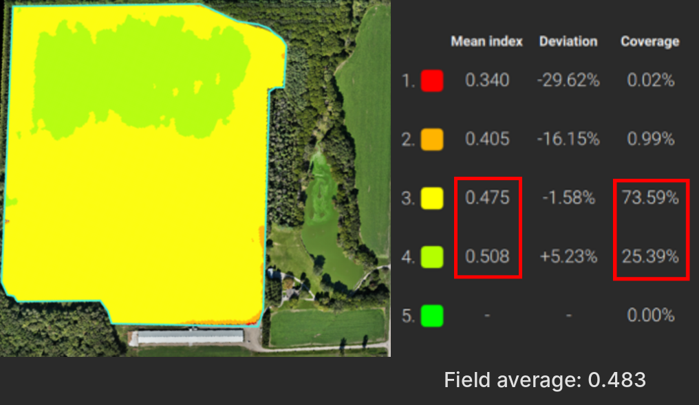
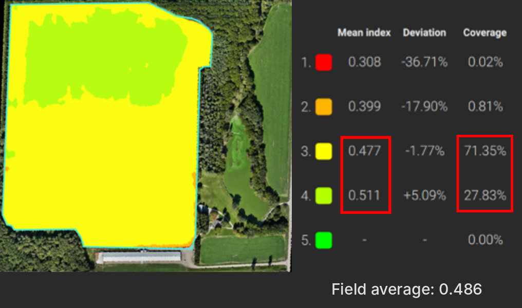
When looking at late September, the results are more pronounced.
The field’s average NDRE was 0.389 without a CRP and 0.408 with one. Approximately 5% lower. Basing decisions on data skewed this much could result in unnecessary and costly decisions.
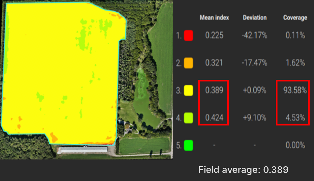
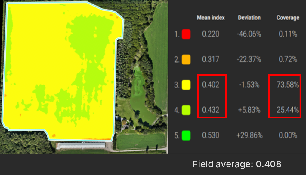
Note: Zone maps use Pix4Dfields’ default equal-interval ranges and are shown for illustration. Appropriate zone intervals for a specific property should be set by your agronomist or turf specialist.
Want this kind of accuracy in your field data? Book a demonstration flight, then decide if a full survey is right for your farm.